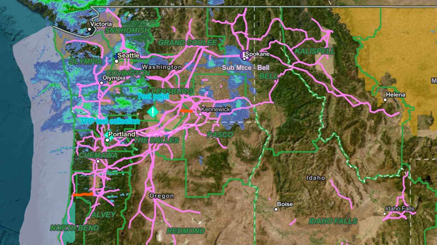
Testing has begun on a new field reporting tool affiliated with the Situational Awareness Viewer, a hub for information impacting the transmission system around BPA’s service territory.
wave

The viewer aims to provide decision-makers with as much available information as possible to help them make choices based on impact to BPA operations. 

Dominic Caudron, Emergency Management

A Bonneville Power Administration field crew scouts an out-of-service transmission line, searching for the cause of the outage when they find a downed tree. A crewmember pulls out a mobile device and inputs necessary information and adds photos to a field report. Within minutes, that data is uploaded to BPA's Situational Awareness Viewer, a geospatial incident map, for others to see.

Field reporting is the latest tool being integrated into the SA Viewer, adding a new level of functionality. Reports give field crews the ability to record real-world incidents and upload them directly to the cloud-based system. Transmission Field Services personnel from the Bell District began beta testing the new feature in early May in coordination with BPA's Emergency Management and Geomatics teams.  

At its core, the SA Viewer serves as an information hub, displaying incidents, weather and other valuable information across the agency's service territory. Dominic Caudron, Emergency Management, and Becca Woods, Geomatics, have been at the forefront of developing the viewer and forming the Situational Awareness workgroup. Cary Chaffe, also from Geomatics, has been working alongside Caudron and Woods to develop the field reports and tailor them to fit certain requirements.

“The viewer aims to provide decision-makers with as much available information as possible to help them make choices based on impact to BPA operations," Caudron said. This includes regional and district managers, Incident Management team members, and BPA Operations.

Development for the viewer began in 2020 , which at the time consisted of a map of BPA's service territory with an overlay of basic weather data. Since then, it has seen yearly updates adding new data sets and functional improvements. “We added quite a few links to BPA and external information sources," Woods said. “We're adding improvements that make the viewer more of a one-stop shop."

The viewer shares some similarities with BPA's Enterprise Geographic Information System (eGIS) Livemaps. Both are Esri products, a company that develops GIS software. Unlike Livemaps, which is hosted on BPA's BUD network, the SA Viewer is an online cloud-based system stored on Esri's servers. The viewer pulls both open-source and BPA data, allowing Emergency Management to provide holistic data and situational awareness of hazards to the rest of the agency. 

“These data sources include an all-hazards approach," Caudron said. “The SA Viewer is pulling data from the U.S. Geological Survey, National Interagency Fire Center, Centers for Disease Control and Prevention, Department of Transportation and much more."

Common operating pictures, or COPS, are tools that provide a consistent view of an incident to all stakeholders and help manage the massive amount of data available on the SA Viewer. While there are multiple COPs to look over, the SA Viewer's general COP has the most usage as it monitors daily activities and small incidents. The SA Viewer also includes incident COPs for fire, geologic and pandemic-related incidents that are valuable resources for incident management teams. Field reports uploaded to the viewer will be visible in the general and incident COPs.

For training purposes, Caudron said the Viewer also has a training and exercise COP with its own field reporting app.

The reports themselves are compact in nature. Users can fill out dropdown menus with necessary identifying information and upload up to three images. “Photos are very data-intensive, so too many images could potentially put increased strain on the viewer and affect overall performance," Caudron said. “We're keeping field reports up on the viewer for 48 hours; then, they disappear off the map unless Transmission Field Services reactivates those reports."

Crews that find themselves without internet connection can still fill out and submit field reports. Caudron said the reports are sent to the viewer as soon as the user regains an internet connection.

Beta testing for field reporting will be ongoing for at least 18 months before full deployment. Caudron said the next phase of the field report beta testing will include two more field districts. After that, field reporting will be deployed throughout all BPA districts.

Related News